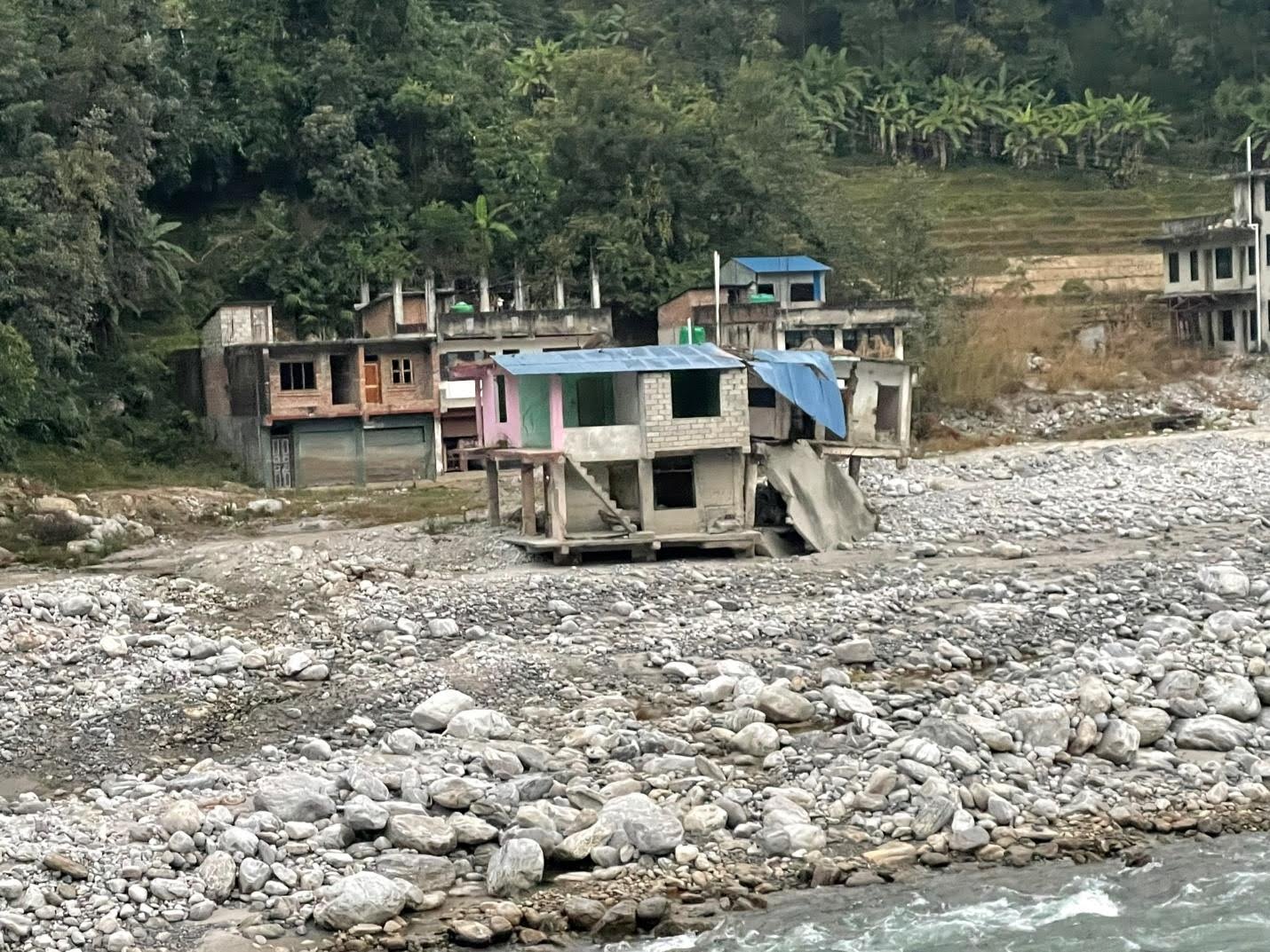
 Damaged houses following a sediment cascade associated with landsliding that devastated a community in Nepal.
 Catalyzing cascading land surface hazards
Project by Professor Dimitrios Zekkos

Professor Dimitrios Zekkos has been conducting research on natural hazards with the goal of reducing their impact on communities and infrastructure. Through his research, he has deployed in many countries following natural disasters, including Nepal, New Zealand, Japan, Greece, Dominica, and, of course, several places in the United States that have been hit by earthquakes, monsoons, hurricanes, and tropical storms.
Zekkos is co-leading a team of researchers from several Universities with the goal of understanding the impact of the interdependencies between hazards, and particularly how the footprint of a natural hazard evolves with time.
A particular focus is the integration of regional-scale monitoring with regional-scale simulations that capture the triggering of landslides following earthquakes and storms, as well as the quantification of landslide run-out that may affect people and infrastructure at lower elevations than the landslides.
Monitoring technologies include satellites, aerial vehicles, as well as geophysics, that is coupled with more localized measurements conducted as part of conventional subsurface investigations. To integrate the monitoring data and integrate it with numerical models, advanced data analysis techniques and machine learning algorithms are used to provide more accurate and reliable information about the underlying geological and hydrological conditions. This information can be used to identify potential hazards and develop strategies for mitigating their impact.