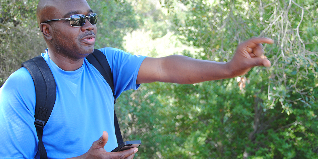
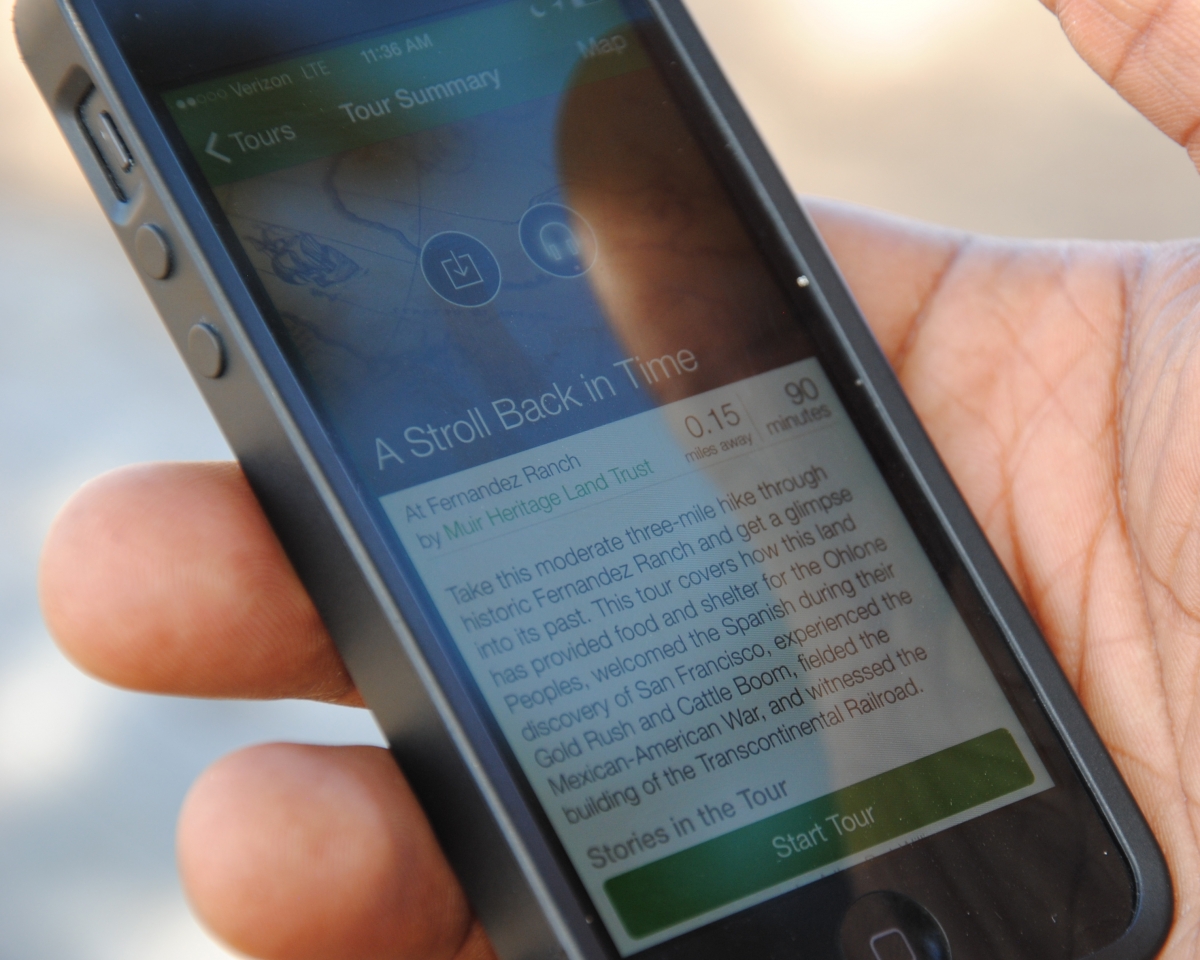
 On tour with Canogle co-founder Arthur Bart-Williams. (Photo by Kristine Wong)
Pocket-sized docent tours
For many independent travelers and hikers, it’s a longstanding conundrum. How can one soak in the sights, sounds and smells of a new place — and learn all about its history — without getting buried in the text of a guidebook or a cellphone screen?
“About 13 years ago, my wife and I were on our honeymoon in Maui,” says Arthur Bart-Williams (B.S.’88 CE). “But her head was in the guidebook’s maps. She said that someone should be telling us the information instead, since she was missing it all.”
The dilemma inspired the Sierra Leone native and East Bay resident to found Canogle, a startup that launched POINT, a mobile phone app that streams hands-free audio tours. Since the phone’s GPS system triggers the app to advance to the next tour “point,” users can devote all of their attention to their surroundings.
Once returning home, Bart-Williams wasted no time. “I did a business plan and built a prototype,” he says.
But it wasn’t long before the entrepreneur — now Canogle’s CEO — got pulled away raising children and taking on new projects. Still, the idea kept on popping up in his mind every few years.
Finally, in 2010, Bart-Williams decided to finally do something about it. He founded Canogle with his brother Samuel, who serves as the startup’s technical lead.
Around that time the team met Linus Eukel, the head of the John Muir Land Trust, the nonprofit organization that manages 2,000 acres of open space in Contra Costa County.
“Linus Eukel understood the potential of what we were trying to do right away,” Bart-Williams says. “They were looking for a way to engage new audiences on their property — a younger generation and a broader demographic.”
 Canogle in action at Fernandez Ranch. Photo by Kristine Wong.The land trust signed up Canogle to develop a set of tours at its Fernandez Ranch property straddling Hercules and Martinez.
In late 2013, the app launched with its first tour highlighting the history of the 702-acre property.
On a recent morning, I joined Bart-Williams for a hike at the ranch, where we stood at the trailhead and listened to the first point on the tour.
“Welcome to Fernandez Ranch,” says the tour guide. “A lot has happened here in 7,000 years.”
But rather than focusing on its rich history alone — one that includes the Ohlone people, the Gold Rush and the Mexican-American War — it consistently weaves together the past with the present while drawing the user’s attention to points on the landscape: at a vista overlooking train tracks near Rodeo Creek, the app tells of the crucial role that Chinese immigrants played in building the Central Pacific Railroad; then near a grassland area of the ranch, the tour explains that while the cattle is used today to keep the forest floor free of vegetation, the Ohlone would set fires to accomplish this instead.
“It’s an art and a science,” Bart-Williams said of developing the tours as we hiked up an incline revealing a panoramic view of the rolling golden hills. “We brought in naturalists, historians and other experts, walked the trail with them and interviewed them to get the stories for each point.”
Then, the company conducted beta testing by taking hikers out on the trail and asking for feedback. The entire process to complete the first tour took six months.
“We’ve learned a lot about how to tell a story in a way that gets people to care about it,” he said. “Now, we can develop tours much faster.”
But Bart-Williams said that just one mention of a group on a tour isn’t always enough. He envisions that tours can be developed from multiple perspectives of the same place.
“We’ve found that people connect to the tours when the material is authentic,” he said. “It gives a more in-depth understanding of a place. It’s okay if it’s a little controversial.”
Today, the app offers hikers four more tours at Fernandez Ranch highlighting its flora and fauna, the results of a 2010 restoration project, a “planet walk” that makes the connection between the solar system and the land, and the original history tour translated into Spanish.
Canogle has also partnered with the San Francisco Bay Trail Project and the California Coastal Conservancy to develop additional tours in the Bay Area — including ones at the Rosie the Riveter National Historic Park in Richmond, the Bay Trail at Alviso’s salt ponds, Hamilton Wetlands in Novato and along the Napa River in American Canyon.
There’s even a tour that was developed with the UC Berkeley College of Natural Resources about the stories behind the trees on campus.
But Bart-Williams’s vision goes beyond tours in the outdoors created by experts. In the next few months, Canogle will release the second version of the app — rebranded as Rovr — and open up the platform where anyone can create a tour.
“We’re looking for storytellers of places to be beta testers,” he says of Rovr. “It’s just not a tour of where you can get the best cup of coffee, but why and how that coffee shop came to be.”
Those first efforts involve collaborating with the Contra Costa County Office of Education, where local teachers will help students to create tours at West Field Farms and Mount Wanda (managed by the John Muir Land Trust) for other youth centered around science, technology, engineering and math.
While the app will be free for individual users, Canogle plans to make money by charging those who want to develop tours for commercial use, or check analytics. They’re also exploring a sponsorship model, where companies or organizations can pitch in.
But for Bart-Williams, the app ended up becoming more than just a professional journey. Along the way, the entrepreneur developed a new appreciation and love for the outdoors..
“I fell in love with open space,” he said. “Some of best meetings were outdoors on trails — I ended up going on more docent-led hikes than I had in my entire life.”
You appreciate the environment in a whole new way, he said, when you take a tour on the trail.
“It makes all the difference,” he says. “We need the technology so more people can experience this.”
